Property Record
4505 Brainerd Rd, Chattanooga, TN 37411


NEARBY LISTINGS FOR SALE OR LEASE
Property Detail
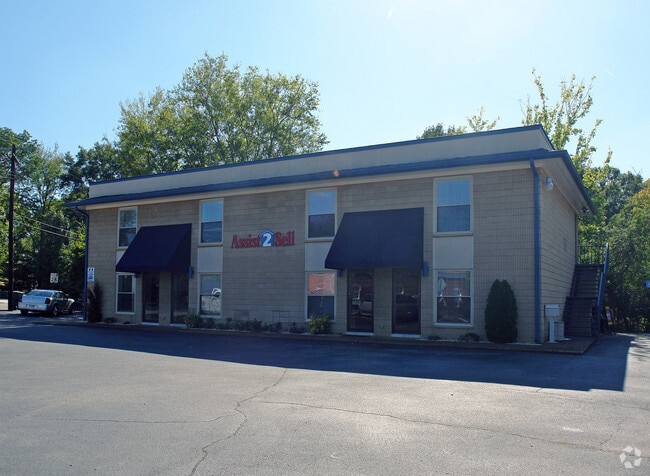
4505 Brainerd Rd
Chattanooga, TN-GA
Belvoir Park Addition
157J-H-006
PT LTS 37 38 BLK 8 BELVOIR PARK REV PB8 PG49
Officebuilding
Hamilton
X
Tennessee
47065C0363G
37,38
2024
0.14 AC
2024
Outlying Chattanooga
002900
Chattanooga
2,208 SF
DEMOGRAPHICS near 4505 Brainerd Rd
1 Mile
3 Mile
5 Mile
2024 Total Population
10,497
67,671
151,821
2029 Population
11,159
71,978
161,759
Pop Growth 2024-2029
+ 6.31%
+ 6.36%
+ 6.55%
Average Age
40
39
39
2024 Total Households
4,508
27,914
62,979
HH Growth 2024-2029
+ 6.41%
+ 6.43%
+ 6.72%
Median Household Inc
$47,993
$44,754
$46,442
Avg Household Size
2.30
2.30
2.30
2024 Avg HH Vehicles
2.00
2.00
2.00
Median Home Value
$182,932
$171,681
$177,927
Median Year Built
1956
1962
1969
Nearby Places
Map Layers
Map Styles
 Street
 Aerial
- Restaurants
- Banks
- Shops
- Fitness
- Groceries
PUBLIC TRANSPORTATION
AIRPORT
Lovell Field
DRIVE
WALK
Distance
Lovell Field
9 min
3.2 mi
SALE & LEASE HISTORY
LISTING DATE
SALE/LEASE

Jul 14, 2023
For Lease
Nearby Properties
Address
Land Use
TOTAL SIZE
Lot Size
Zoning
Address
Land Use
TOTAL SIZE
Lot Size
Zoning
832.10 AC
M1
Address
Land Use
TOTAL SIZE
Lot Size
Zoning
5,008 SF
17.97 AC
R1
Address
Land Use
TOTAL SIZE
Lot Size
Zoning
43,470 SF
1.26 AC
R4
Address
Land Use
TOTAL SIZE
Lot Size
Zoning
298,953 SF
16.26 AC
R3
Address
Land Use
TOTAL SIZE
Lot Size
Zoning
790,207 SF
53.84 AC
C2
Address
Land Use
TOTAL SIZE
Lot Size
Zoning
5,888 SF
10.20 AC
R3
Address
Land Use
TOTAL SIZE
Lot Size
Zoning
209,168 SF
23.28 AC
C2
Address
Land Use
TOTAL SIZE
Lot Size
Zoning
85,068 SF
9.57 AC
Address
Land Use
TOTAL SIZE
Lot Size
Zoning
67,735 SF
17.32 AC
M1
Address
Land Use
TOTAL SIZE
Lot Size
Zoning
66,027 SF
2.84 AC
C2
Address
Land Use
TOTAL SIZE
Lot Size
Zoning
88,285 SF
7 AC
R3
Address
Land Use
TOTAL SIZE
Lot Size
Zoning
215,385 SF
14.10 AC
UR
Address
Land Use
TOTAL SIZE
Lot Size
Zoning
151,314 SF
6.60 AC
Address
Land Use
TOTAL SIZE
Lot Size
Zoning
91,448 SF
R1
Address
Land Use
TOTAL SIZE
Lot Size
Zoning
55,289 SF
9.33 AC
C2
Address
Land Use
TOTAL SIZE
Lot Size
Zoning
41,872 SF
6.29 AC
Address
Land Use
TOTAL SIZE
Lot Size
Zoning
41,872 SF
7.09 AC
C2
Address
Land Use
TOTAL SIZE
Lot Size
Zoning
71,458 SF
19.22 AC
M2
Address
Land Use
TOTAL SIZE
Lot Size
Zoning
2,651 SF
9.50 AC
Address
Land Use
TOTAL SIZE
Lot Size
Zoning
35,740 SF
5.20 AC
R2
Address
Land Use
TOTAL SIZE
Lot Size
Zoning
759 SF
5 AC
Address
Land Use
TOTAL SIZE
Lot Size
Zoning
15,250 SF
10.57 AC
R4
Address
Land Use
TOTAL SIZE
Lot Size
Zoning
45,409 SF
6.83 AC
Address
Land Use
TOTAL SIZE
Lot Size
Zoning
42,474 SF
2.11 AC
Address
Land Use
TOTAL SIZE
Lot Size
Zoning
37,400 SF
1.83 AC
R3
Address
Land Use
TOTAL SIZE
Lot Size
Zoning
87,335 SF
R4
Address
Land Use
TOTAL SIZE
Lot Size
Zoning
33,682 SF
0.93 AC
UGC
Address
Land Use
TOTAL SIZE
Lot Size
Zoning
1,440 SF
11.06 AC
Address
Land Use
TOTAL SIZE
Lot Size
Zoning
49,948 SF
2.38 AC
C2
Address
Land Use
TOTAL SIZE
Lot Size
Zoning
18,628 SF
3.60 AC
R2
The World's #1 Commercial Real Estate Marketplace
Connect with us
© 2025 CoStar Group
The information above has been obtained from sources believed reliable. While we do not doubt its accuracy we have not verified it and make no guarantee, warranty or representation about it. It is your responsibility to independently confirm its accuracy and completeness. Any projections, opinions, assumptions, or estimates used are for example only and do not represent the current or future performance of the property. The value of this transaction to you depends on tax and other factors which should be evaluated by your tax, financial, and legal advisors. You and your advisors should conduct a careful, independent investigation of the property to determine to your satisfaction the suitability of the property for your needs.